

Don’t waste time on horizon picking, master the RGT technology and create value from your entire seismic cube in one click!
Adopt holistic and semi-automated seismic interpretation approach based on an iterative
Model-Grid and Relative Geological Time (RGT) model creation process.
This comprehensive method utilizes a three-step computer-aided workflow:
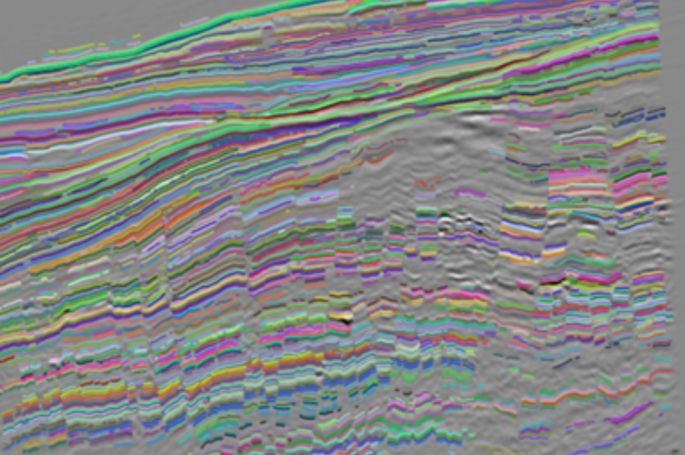
- Autotracking: a powerful algorithm converts all seismic reflections into horizons and organizes them stratigraphically.
- QC and Iteration: flexibility and ownership is given to the interpreter who can interactively edit auto-tracked horizons and update the Model-Grid in real-time to obtain a fit-for-purpose solution. Repeated cycles of adjustments enable refining the product to the desired degree.
- A Relative Geological Time (RGT) model is consecutively computed from the seismic based on the aforementioned refined Model-Grid. The RGT model plays a central role in PaleoScan integrated workflows as many interpretative applications are directly derived from it.

From the RGT workflow, you can instantly visualize more than 30 attributes and realize more than 40 attributes derived from seismic or RGT model.
Whether you are at the dawn or the dusk of your interpreter career, our 3-star workflow relies on our “body and soul” stratigraphic attributes: Spectral Decomposition and Thinning.
- Spectral decomposition is a technique relying on the transformation of each individual 1D seismic trace into a 2D time-frequency representation using either Short Time Fourier Transform (STFT) or Continuous Wavelet Transform (CWT). It aims at extracting discrete frequency magnitudes to tune beds according to their thicknesses and provides high precision imaging of source-to-sink systems and reservoir complexity and heterogeneities.
- The thinning attribute is the vertical derivative of the RGT Model. It shows for every seismic sample the instantaneous variation of the relative geological ages. It highlights zones of strata convergence and divergence leading to the interpretation of geometrical relationships within sedimentary units, relative accommodation space variations, and seismic stacking patterns.

Wondering about how to quickly assess your depositional environment and target sweet spot areas at an early stage?
Explore your seismic volumes faster, further and beyond the seismic sampling!
One of the main applications derived from the RGT model is the ability of extracting an infinite number of iso-age surfaces gathered within a so-called “Horizon stack” product. This high-density stratal slicing enables to interactively tie any key surface to major events and dynamically flatten or sculpt the data allowing you to accelerate data recognition, detection and characterization of fine-scale geologic features.
Map your attributes on any horizon and start screening through your geomorphological data in no time!
The vast range of attributes, including Spectral and Frequency decomposition, and the excellent color blending functionality make high quality and fast attribute analysis. Visualise geological bodies from large scale source-to-sink systems to reservoir scale features by assigning attributes or frequency decomposition to each channel. Save time and effort on focusing more on integrating your knowledge and understanding your depositional history.
Decompose your image in 2 or 3 different channels and play around with the image contrast. Choose the blending method to combine the input accordingly (attribute derived from seismic, RGT, frequency or spectral analysis). Emphasize seismic signatures, delineate and extract them as geobodies.
Various blending methods are available:
- Alpha blending
- RGB (Red, Green, Blue)
- CMY (Cyan, Magenta, Yellow)
- HSV (Hue, Saturation, Value)
- HSL (Hue, Saturation, Lightness)

Build your structural framework in the blink of an eye. Tackle dense, complex fault networks faster than ever with our hands-on (AI-assisted) Automated Fault Extraction (AFE) workflow.
Our innovative solution proposes an optimized computation of variance values at a given voxel location using different scanning orientations (dips/azimuth) to automatically extract set of faults from a seismic volume. PaleoScan™’s technology gives you the control to investigate and identify optimal parameter settings every step of the way!
Fault management tools such as Fault Merge Assistant and dip/azimuth filtering stereonet are tremendously useful to speed up the interpretation time and extraction of meaningful and valuable fault sets. The resulted extracted faults can then be used to optimally constrain the RGT model and the Geocellular grid.
Sealing mechanisms and fault geomechanical properties are crucial information in prospect evaluation and productivity enhancement and can be preliminary assessed through our Fault throw attribute and Allan diagram tool.

Strengthen your 3D chronostratigraphic framework, identify key stratigraphic surfaces, and track the spatial and lateral evolution of mega-sequences and their depositional environments with our Seismic Stratigraphy module.
Wheeler diagrams, or chronostratigraphic charts, provide a useful way to look at stratigraphic temporal relationships, particularly with regards to understanding the location and timing of erosional and non-depositional events.
Our wheeler transform optimized algorithm allows a direct translation of stacking patterns and systems tracts into relative geological times by flattening the seismic data along chronostratigraphic surfaces. In this way, the sedimentary layers can be considered in terms of base-level changes and sedimentation interplay, unconformities and hiatuses allowing you to be more predictive in locating reservoir, seal and source-rock facies.

Build a robust stratigraphic framework, control and predict your facies distribution and reservoir quality by integrating stratigraphic markers and well log data to your seismic data.
PaleoScan™ provides a toolkit for visualizing, editing and analyzing well data. Create geological cross-sections, quality check your results and use markers and surfaces to simultaneously flatten your well correlation panels, cubes and lines.
Scan, detect and extract 3D geobodies using the seismic facies-based workflow available on the Cross-plot functionality.
Interactive cross plotting of attributes and well log data is a fundamental tool for lithofacies classification and fluid substitution effects understanding.
Both manual and automatic classification methods are available to create and organize your lithology or facies classes. By thoroughly and interactively analyzing seismic signatures, you can select a meaningful range of values within your cube and extricate the associated geobodies.
Lithofacies classification performed from well log data results in the creation of discrete well logs that can be further used in quantitative reservoir evaluation.

Bridge the gap from seismic interpretation to reservoir modeling.
Perform an initial assessment of the 3D distribution of reservoir heterogeneities and petrophysical properties by integrating all available well-log data.
Using the same RGT-driven layers and fault networks input combined with stratigraphic termination management and stacking pattern assignment, a Geocellular grid can be computed and populated with seismic facies or rock properties. This regular stratigraphic grid of corner point type manages stair-stepped fault modeling.
The thorough well analysis from all types of wireline logs achieved by PaleoScan’s classification “Cross-plot” tool leads to static reservoir property extraction. Property Modeling module proposes several propagation methods to interpolate between well logs such as inverse distance, kriging and co-kriging which can be visualized in real time on a surface or a cross-section along wells.
One of the signature workflows uses a priori Impedance Acoustic cubes from property modeling to constrain Colored Inversion and Deterministic Inversion processes. The subsequent results are finally used to populate the Geocellular grid with porosity and fluid content properties.
To go further in the Quantitative Interpretation:
- Forward modeling (synthetic seismic generation)
- Interval velocity model generation


PaleoScan™ Core Application
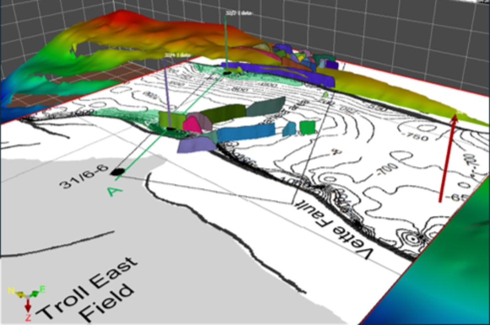
PaleoScan™ Geology

PaleoScan™ Reservoir

PaleoScan™ Seismic
PaleoScan™ Overview
PaleoScan™ is Eliis’s flagship subsurface interpretation platform, combining a semi-automated Relative Geological Time (RGT) workflow with AI-assisted tools to accelerate, enhance, and de-risk geological interpretation — from first horizon pick through to reservoir-ready models. GeoEnergy delivers PaleoScan™ as an authorised reseller of Eliis, bringing the platform’s latest release, PaleoScan™ 2026.2, to geoscientists across the region.
PaleoScan™ 2026.2
PaleoScan™ 2026.2 brings an AI core directly into the RGT interpretation workflow, extending automation and accuracy in the most demanding geological settings — heavily faulted reservoirs, subtle stratigraphic traps, and noisy or low-frequency data.
- Integrated Geological Modelling — build RGT models while interpreting, creating robust tectonostratigraphic frameworks as you go.
- Reservoir Modelling Workflow — move seamlessly from interpretation straight into geological grids and reservoir-ready models.
- AI-assisted interpretation — automated geobody segmentation and fault extraction, with the interpreter in control at every step.
Prospectivity
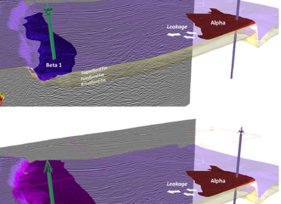
Move from interpretation straight to decision-making with Prospect Evaluation — identify traps, rank prospects, and shorten time-to-decision on acreage access.
Leveraging the Horizon Stack and petrophysical data already built during interpretation, PaleoScan™’s Prospect Evaluation toolbox lets geoscientists identify and map traps for hydrocarbons or CO₂ storage, compute trap volumes, define injection point strategies, visualise fill-spill and leakage points, and rank prospects to support portfolio and acreage strategy.
Advanced Seismic Interpretation
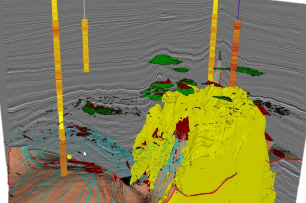
Strengthen your 3D chronostratigraphic framework, identify key stratigraphic surfaces, and track the spatial and lateral evolution of mega-sequences and their depositional environments.
Our Wheeler-transform optimized algorithm allows a direct translation of stacking patterns and systems tracts into relative geological times by flattening the seismic data along chronostratigraphic surfaces — helping you more accurately locate reservoir, seal and source-rock facies.
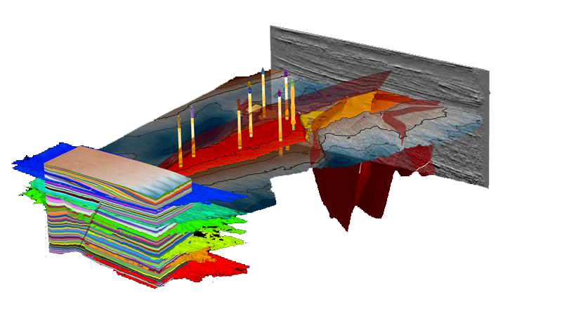
PaleoScan™ Applications
PaleoScan™ Geology
Build chrono-stratigraphically consistent geological models straight from seismic, using the semi-automated RGT workflow — from first-pass horizon autotracking through to a fully refined structural and stratigraphic framework, at basin to reservoir scale.
PaleoScan™ Reservoir
Move from interpretation to reservoir-ready models with the Reservoir Modelling Workflow: generate watertight structural models and populate Geocellular grids with facies and petrophysical properties derived directly from your well and seismic data.
PaleoScan™ Seismic
Generate and interrogate a full suite of RGT-based and spectral attributes, apply AI-assisted fault extraction, and run forward modelling to tie synthetic and real seismic — constraining your interpretation at every step.
Benefits
Faster interpretation cycles through semi-automated RGT-based horizon tracking
AI-assisted fault and geobody extraction that keeps the interpreter in control
A direct path from interpretation to reservoir-ready geocellular grids
Interactive prospect and CO₂ storage evaluation for faster decision-making
A single chrono-stratigraphic framework spanning basin to reservoir scale
Local licensing, deployment, training and support through GeoEnergy
GeoEnergy is an authorised reseller of Eliis, the French geoscience software company behind PaleoScan™. All licensing, deployment, training, and support for PaleoScan™ in our region is delivered through GeoEnergy in direct partnership with Eliis.